
September 29, 2026
An open-source intelligence platform that tracks flights, satellites, and CCTV on a 3D globe in your browser while running multiple network reconnaissance tools.
Product facts
- Type
- Web App / SaaS
- Category
- Lifestyle & Entertainment › Weather and Maps
- Pricing
- Free
- Launched
- Sep 29, 2026
- Listed
- Sep 29, 2026
- Website
- osirisai.live
Overview
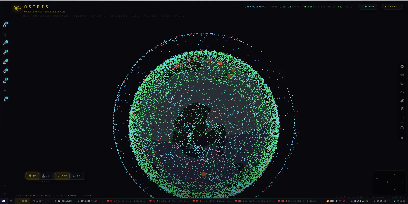
OSIRIS is a web-based Open Source Intelligence (OSINT) toolkit and platform developed by Osiris Project, currently at version V5.0. Positioned as an open-source alternative to Palantir, it consolidates multi-source data into a single browser-accessible interface. ### Core Capabilities - **3D Globe Visualization**: Toggle between 3D and 2D map views to display the real-time locations of over 10,000 aircraft, 2,000 satellites, and global CCTV cameras on the globe. - **Network Reconnaissance Tools**: Built-in Nmap scanning, DNS lookups, WHOIS queries, SSL certificate analysis, and threat intelligence—all executable without leaving the browser. - **Multi-Source Data Integration**: Aggregates over 20 data sources covering real-time earthquakes, wildfires, cyber threats, and conflict updates, along with annotated reference layers such as nuclear facilities. - **Real-Time Monitoring Scope**: Beyond aviation and satellites, it supports real-time global monitoring of maritime activity, weather, and cyber threats. ### Interface & Interaction The interface provides access to modules including Recon, Space, Markets, Alerts, Draw, Route, Search, ArcGIS, and Remote. It also offers cursor position hover display, zoom controls, keyboard shortcuts (press ? to view), fullscreen mode (F key), and view reset (R key). ### Target Audience Ideal for security researchers, OSINT analysts, and anyone needing global situational awareness. The project is free and open source.
Key features
- 3D/2D Globe View: View entities and data layers on a 3D globe or 2D map.
- Real-Time Flight Tracking: Track the live positions of over 10,000 aircraft on the map.
- Satellite Tracking: Display and track the orbits and positions of over 2,000 satellites.
- Global CCTV Access: View the distribution of CCTV cameras worldwide on the map.
- Nmap Scanning: Run Nmap network scans directly in your browser.
- DNS & WHOIS Lookups: Perform DNS lookups and WHOIS queries.
- SSL Certificate Analysis: Inspect and analyze SSL certificates for targets.
- Threat Intelligence: Integrated cyber threat intelligence queries.
- 20+ Data Sources: Access over 20 real-time feeds including earthquakes, wildfires, conflicts, and cyber threats.
- Reference Data Layers: Provides mapped geospatial reference data such as nuclear facilities.
- Maritime & Weather Monitoring: Real-time monitoring of maritime activity and weather conditions.
Releases
Notify me Initial · OSIRIS
Q&A
- What is OSIRIS?AI-generated
- OSIRIS is an Open Source Intelligence (OSINT) toolkit and platform developed by Osiris Project. It runs entirely in the browser and is described as an open-source alternative to Palantir.
- Do I need to install software to use OSIRIS?AI-generated
- No. All OSIRIS features, including Nmap scanning and DNS lookups, run directly in your browser.
- Is OSIRIS free?AI-generated
- Yes, OSIRIS is free and open source.
- What types of targets can OSIRIS track?AI-generated
- It tracks real-time flights (10,000+), satellites (2,000+), and global CCTV cameras, while monitoring maritime activity, weather, earthquakes, wildfires, cyber threats, and conflicts.
Bookmark
This product has no owner yet
It was listed by the platform or its author left. If it is your work, prove your relationship to become the owner.
Claim this productAlternatives


The product content on this page was translated by AI from the author's original.